Sidewalk Assessment Solutions
Delivered as a turnkey service
Turnkey robotic sidewalk condition assessments to support ADA Transition Plans, trip-and-fall risk assessments, and capital planning.
Advanced laser and inclinometer sensors capture precise uplift and slope measurements
Comprehensive sidewalk and curb ramp data
Full-service ADA transition plans delivered alongside experienced engineering firms
Accurate, Actionable Data
Whether you’re gathering data for an ADA transition plan or seeking to reduce trip-and-fall risk, we’re here to support you with efficient, repeatable field collection and GIS-ready data outputs.
Sidewalk & PathwayInventory Solutions
ADA Transition Plan Assessments
We offer citywide data on sidewalk and curb ramp conditions as a turnkey service to support your compliance goals.
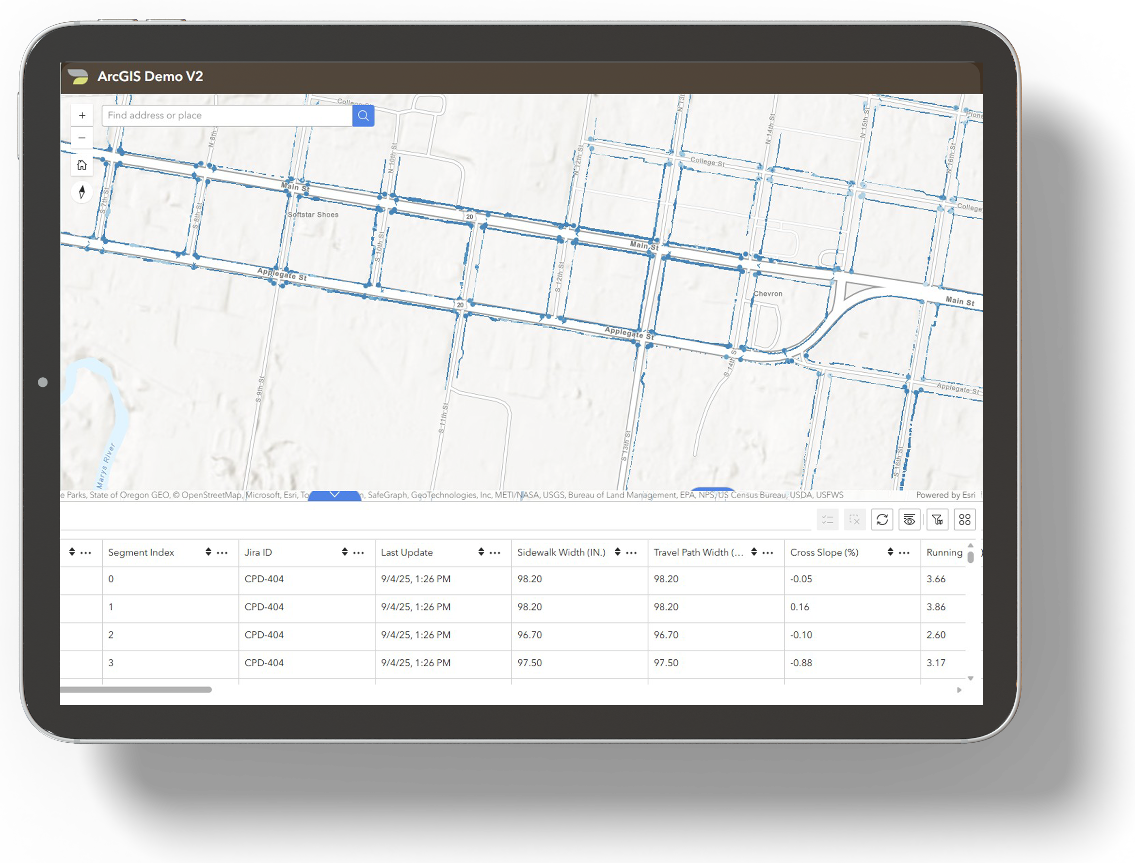
Daxbot collects citywide sidewalk and curb ramp condition data and delivers GIS-ready outputs assessed against PROWAG criteria to support ADA Transition Plans for cities and universities.
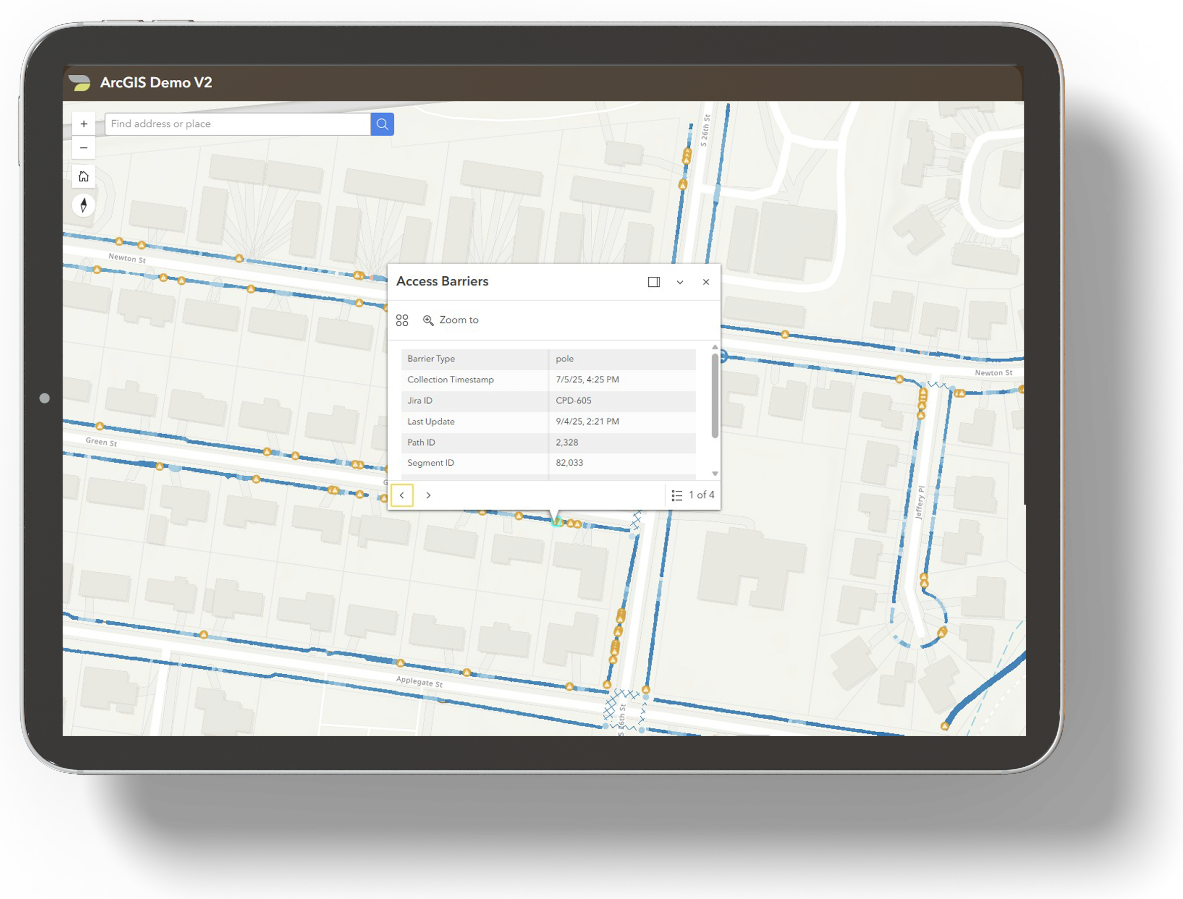
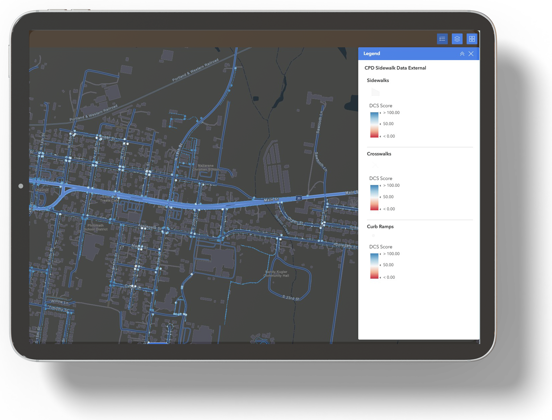
We gather PROWAG-aligned sidewalk and curb ramp evaluation data and deliver it to ArcGIS and similar platforms.
We rank asset segments by compliance score and risk factors to help address the highest-priority barriers first.
We include summary breakdown reports showing repairs needed by phase and category to prevent data overload.
Trip-and-Fall Risk Assessments
We document sidewalk hazards that contribute to trip-and-fall risks.
Daxbot captures and analyzes common trip-and-fall factors, including uplifts, horizontal separation, and spalling.
We map and summarize sidewalk and curb ramp defects and rank segments by the number and severity of risks in each.
We deliver ArcGIS files to you or to a designated third party to support prioritization and risk-mitigation planning.
We provide quantified summaries by phase and category to support program and practical repair planning.
Capital Improvement Planning
We support budget scoping and phased repair planning by providing comprehensive citywide sidewalk data with standardized asset scoring.
Daxbot delivers accurate, actionable condition data in ArcGIS and similar platforms, enabling teams to scope repairs and prioritize improvements in the highest-need corridors.
We provide top-priority sidewalk segments and curb ramps, scored by the number and severity of hazards present.
We deliver project-ready maps and prioritized corridor views that overlay with existing plans, enabling you to bundle repairs into executable projects.
We provide quantified need and scope summaries for use in grant applications and capital improvement program documentation.
Sidewalk & Curb Ramp Inventories
We structure citywide asset layers to support long-term maintenance planning and updates to your records.
Daxbot builds standardized sidewalk and curb ramp layers in ArcGIS, enabling teams to manage assets and maintain records.
We deliver citywide asset layers in ArcGIS to support long-term maintenance planning within your workflows.
We provide transparent, repeatable rankings and scoring to support your budgeting and prioritization.
We deliver ready-to-use GIS layers that integrate with your existing systems, so you do not need to create a new internal platform.
Request More Info:
What Our Partners & Clients Are Saying: